I've been cooped up too long--work, then COVID, then I just didn't have the "umph" to get out there even when I had the free time in December. So I made myself go, and I picked a close although longer hike. Overall it's 7.2 miles. This is SOTA W7U/WS-109 and POTA K-6088 (Red Mountain Wilderness).
In the area:
I didn't want to get too early a start since it's been cold lately. I left at about 9am. There were a few cars parked at the trailhead. This was my second time to this peak, the first was back in 2016. I knew the route was rough, but didn't quite plan the timing right to be there right when I posted my alert. Hiking in I only crossed paths with two others--a trail runner and a lady with a big dog on their way out.
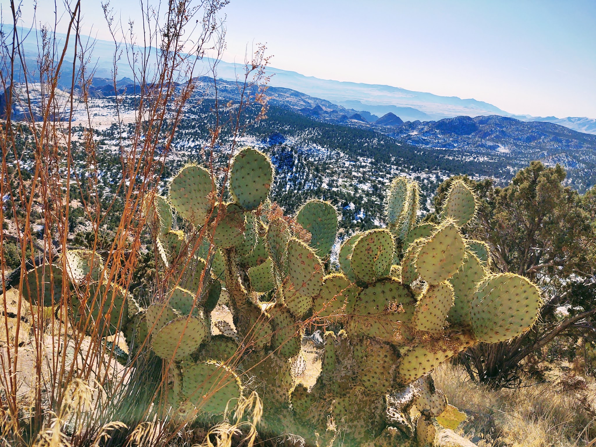
There was snow on the trail as it headed up. My supposed "water proof" boots didn't do a great job. They are several years old and need replacing--I need to do that soon. It's a good hike, very rocky. It's less than a mile before reaching the entrance to the wilderness boundary. Some of my friends abroad find it interesting to see cacti in snow, so I took several pictures of that.
At the base of peak you have to leave the trail. I took a new route this time--not a good choice. It was steep, slow, and scrambling was required. Its at the last 200 vertical feet that you can really see the top. I stayed to the south since it was mostly clear of snow. It was a long hike, but it's always great to reach the top! I didn't the actual benchmark this time, I don't know if it was the snow or rocks were covering it.
On the air:
It didn't take long to get set up. I was on the air an hour later than posted, but with SOTA, that never really matters. It was a good day on air. 20 meters was constant for about 15 mins. I got a S2S with KD0YOB on W9/WI-040 and then I also got John, ZL1BYZ, in New Zealand. With it being later and my feet cold, I didn't stay on overly long. I switched to 40 meters and got two more S2S contacts--N0DNF in Idaho (W7I/SI-215) and KX0R in Colorado (W0C/FR-076).
Total there were 27 qso's and I stayed on for a total of 30 mins. After a last QRZ? with no answer I shut down and started the long trek back. I went extra slow because of the snow and being tired--coming down is more dangerous than going up. I ate some snacks to boost the energy a little, but I was quite tired at the end and my feet hurt from the old boots.
Video of the activation
Date:02/01/2021 | Summit:W7U/WS-109 (Snow Benchmark) | Call Used:AC0PR | Points: 2
| 18:54 | ND0C | 14MHz | CW | |
| 18:55 | K9OZ | 14MHz | CW | |
| 18:55 | WF4I | 14MHz | CW | |
| 18:57 | K4MF | 14MHz | CW | |
| 18:57 | W0MNA | 14MHz | CW | |
| 18:58 | W0ERI | 14MHz | CW | |
| 18:58 | WW7D | 14MHz | CW | |
| 18:59 | K0LAF | 14MHz | CW | |
| 19:00 | N4MJ | 14MHz | CW | |
| 19:00 | W4MPS | 14MHz | CW | |
| 19:01 | VE7EA | 14MHz | CW | |
| 19:02 | KD0YOB | 14MHz | CW | S2S W9/WI-040 |
| 19:06 | W7HO | 14MHz | CW | |
| 19:06 | ZL1BYZ | 14MHz | CW | |
| 19:13 | W7RV | 7MHz | CW | |
| 19:13 | NW7E | 7MHz | CW | |
| 19:15 | N0DNF | 7MHz | CW | S2S W7I/SI-215 |
| 19:16 | K6YK | 7MHz | CW | |
| 19:16 | WA6KYR | 7MHz | CW | |
| 19:17 | KR7RK | 7MHz | CW | |
| 19:17 | KF7WI | 7MHz | CW | |
| 19:19 | N7OOS | 7MHz | CW | |
| 19:19 | K6QCB | 7MHz | CW | |
| 19:21 | KK7A | 7MHz | CW | |
| 19:22 | KX0R | 7MHz | CW | S2S W0C/FR-076 |
| 19:23 | W0JAZ | 7MHz | CW | |
| 19:24 | K6MAA | 7MHz | CW |
Radio-related Equipment:
Linked dipole, homebrewed (4 bands)
Pico Paddle
2,200 MaH LiPo battery
Fishing pole mast
Earbuds
Clipboard
Android MotoZ (US topo map app, spotting, UTC time, recording)
Misc. items (for repair, food, water, etc.)
Thanks for reading!
72,
Mike ACØPR


No comments:
Post a Comment