 |
| The top of the mesa |
Trail report:
 Access is gained from Highway 59 in Utah, which becomes Highway 389 in Arizona. The turn off is a few miles south of Colorado City, AZ onto county road 239 which heads due south for about 11 miles. This county road is a nice dirt road the entire way and can be taken by pretty much any vehicle. The road ends at an old gravel pit which is a mere 150 yards to the high point, and it's
 basically just climbing out of the pit. There are three benchmarks at the top. Flat and rocky with a few short trees and a nice view from the edge. There are rattlers in the area.
The experience:
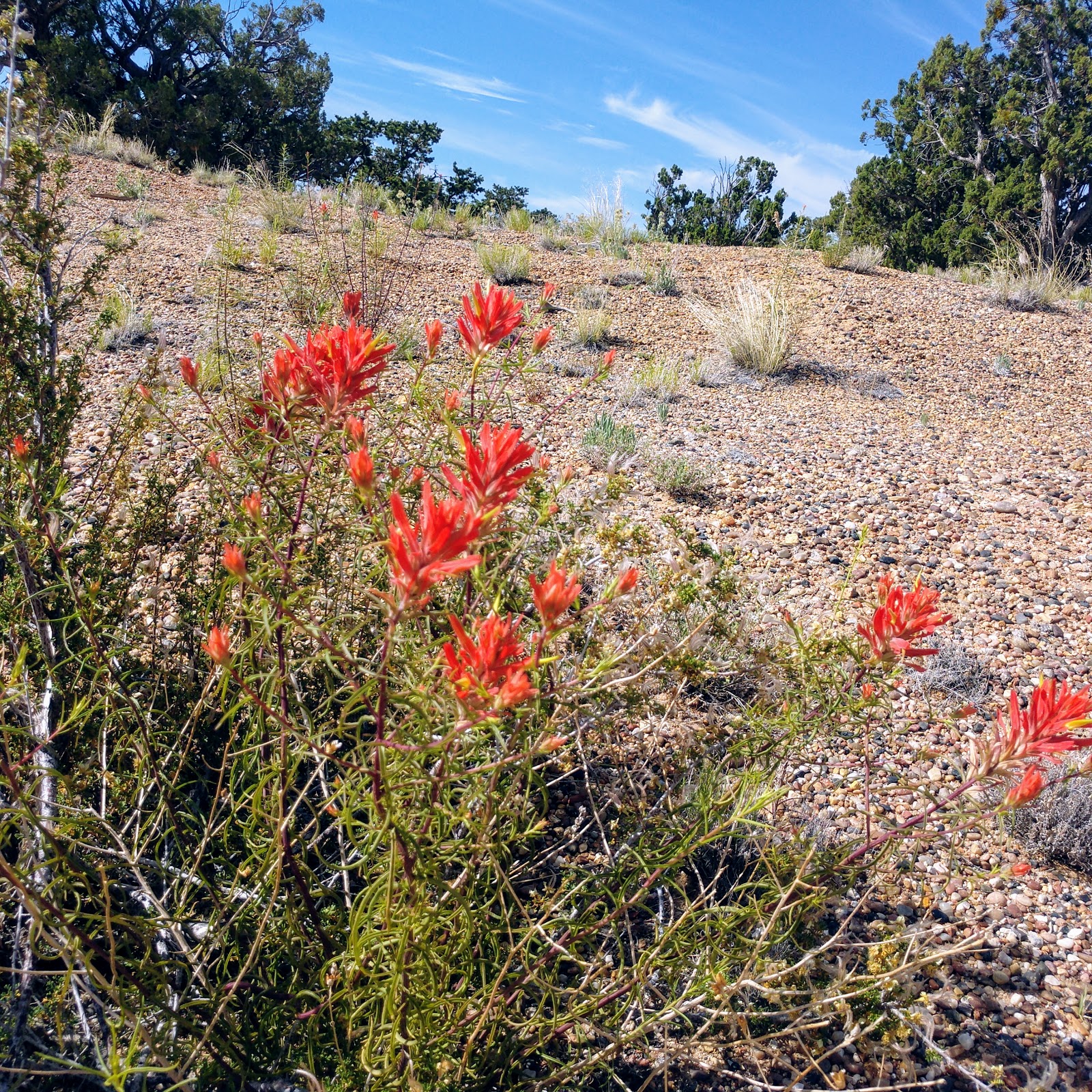
 This is a great time of year to go, the flowers are blooming and it's not terribly hot until about noon. It really shows the beauty the desert can have. There's a rock formation that creates a little shelf that's perfect for setting up. A few rocks nearby to steady the mast and all is ready to go. This was the fourth activation using the Te-Ne-Ke as my main key as a test of how it holds up and how much I like it.
 There was lots of activity so I ended up staying longer than usual. Probably less than half the time I try 30 meters to see how it goes. Normally I do well enough on 20m and 40m that I don't even bother. I thought I would try it out this time--I only ended up with one contact on that band.
Because I had been on so long this time, I went back to 20m to see if there were others out there and I got quite a few more (I had started earlier than normal for me to begin with). The highlight of the morning was getting Lars in Sweden, SA4BLM.
Video of the four activations using Te-Ne-Ke
Date:05/06/2020 | Summit:W7A/NM-062 (Yellowstone Mesa) | Call Used:AC0PR | Points: 6 | Bonus: 3
| Time | Callsign | Band | Mode | Notes |
|---|---|---|---|---|
| 14:27 | KI4TN | 14MHz | CW | |
| 14:45 | K6KM | 14MHz | CW | |
| 14:48 | AB4PP | 14MHz | CW | |
| 14:49 | KH2TJ | 14MHz | CW | |
| 14:49 | AC7P | 14MHz | CW | |
| 14:49 | N7EDK | 14MHz | CW | |
| 14:50 | K6YK | 14MHz | CW | |
| 14:51 | N0RZ | 14MHz | CW | |
| 14:52 | K4MF | 14MHz | CW | |
| 14:52 | NG6R | 14MHz | CW | |
| 14:53 | N6TVN | 14MHz | CW | |
| 14:53 | N4MJ | 14MHz | CW | |
| 14:54 | K1LB | 14MHz | CW | |
| 14:54 | K3TCU | 14MHz | CW | |
| 14:55 | KI5WA | 14MHz | CW | |
| 14:55 | WU7H | 14MHz | CW | |
| 14:56 | K7TP | 14MHz | CW | |
| 14:57 | KA5PVB | 14MHz | CW | |
| 14:58 | AD5TF | 14MHz | CW | |
| 14:59 | WD4CFN | 14MHz | CW | |
| 15:03 | W7RV | 7MHz | CW | |
| 15:04 | KE6MT | 7MHz | CW | |
| 15:05 | WA6KYR | 7MHz | CW | |
| 15:05 | WW7D | 7MHz | CW | |
| 15:06 | K6HPX | 7MHz | CW | |
| 15:06 | W0NF | 7MHz | CW | |
| 15:07 | K8FB | 7MHz | CW | |
| 15:08 | K6QCB | 7MHz | CW | |
| 15:09 | K7SO | 7MHz | CW | |
| 15:15 | WA2USA | 10MHz | CW | |
| 15:20 | K9OZ | 14MHz | CW | |
| 15:20 | W0ERI | 14MHz | CW | |
| 15:23 | K0FX | 14MHz | CW | |
| 15:24 | NG7A | 14MHz | CW | |
| 15:25 | WB2FUV | 14MHz | CW | |
| 15:26 | W2AFE | 14MHz | CW | |
| 15:28 | K0LAF | 14MHz | CW | |
| 15:28 | N4LAG | 14MHz | CW | |
| 15:29 | W0MNA | 14MHz | CW | |
| 15:30 | SA4BLM | 14MHz | CW | |
| 15:33 | N4EX | 14MHz | CW | |
| 15:34 | W0NF | 14MHz | CW |
Contact map:

Radio-related Equipment:
Linked dipole, homebrewed (4 bands)
Earbuds
Other gear (always carried no matter the summit):
Leypin selfie stick tripod (for recording video)
Outdoor Products 3-liter water hydration bladder
First-aid kit
Gloves
Compass
Trekking poles
Clipboard
Android MotoZ (US topo map app, spotting, UTC time, recording)
Guying kit (rarely used on activations)
Hoodie
Rain jacket
Beanie
Extra socks
Small bungees (for securing mast to bush, tree, etc.)
Misc. items (for repair, food, matches, etc.)
Thanks for reading!
72,
Mike ACØPR
No comments:
Post a Comment